Sites
Themed walk on city history


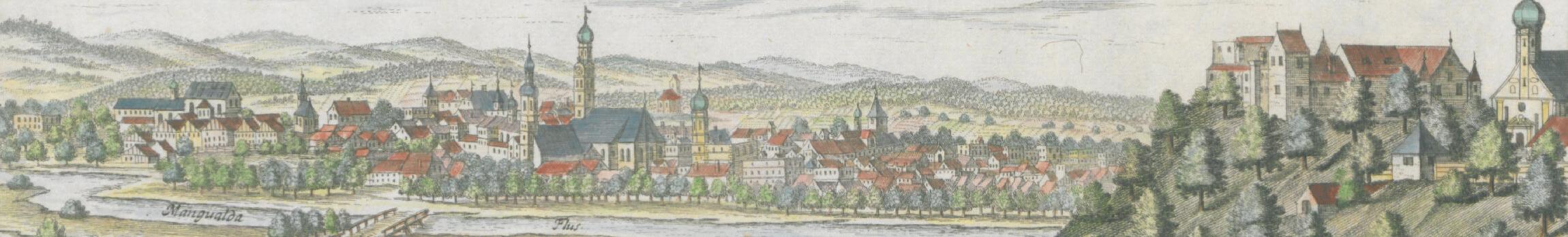
From market to city
Rosenheim was already a trading centre in the Middle Ages for all kinds of goods transported on the Inn. The settlement at the bridge over the Inn, which hails back to Roman times, evolved into a transport hub back in the day. Rosenheim’s right to hold a market was conferred in 1328 and it grew into one of Bavaria’s most important marketplaces. Economic decline came during the 17th century with the fall in Inn shipping and the consequences of the Thirty Years’ War, the Plague and the great fire of 1641.
Rosenheim experienced an unprecedented economic upswing in the mid-19th century, boosted by the building of the third Bavarian salt works in 1810 and the Munich to Salzburg railway line, which began operation in 1856. The population multiplied in the following fifty years from 3,000 to 14,000 inhabitants. Far-reaching changes came in both political and social terms, with many new jobs created in trade and industry. King Ludwig II therefore conferred city rights on Rosenheim in 1864.
The upswing of the day was reflected in the development of the urban structure – the narrow boundaries of the medieval market were obliterated and Rosenheim grew into the economic centre of Southeast Bavaria. Numerous developments and buildings of this promoterism period are still recognisable today in this university and timber town’s cityscape.
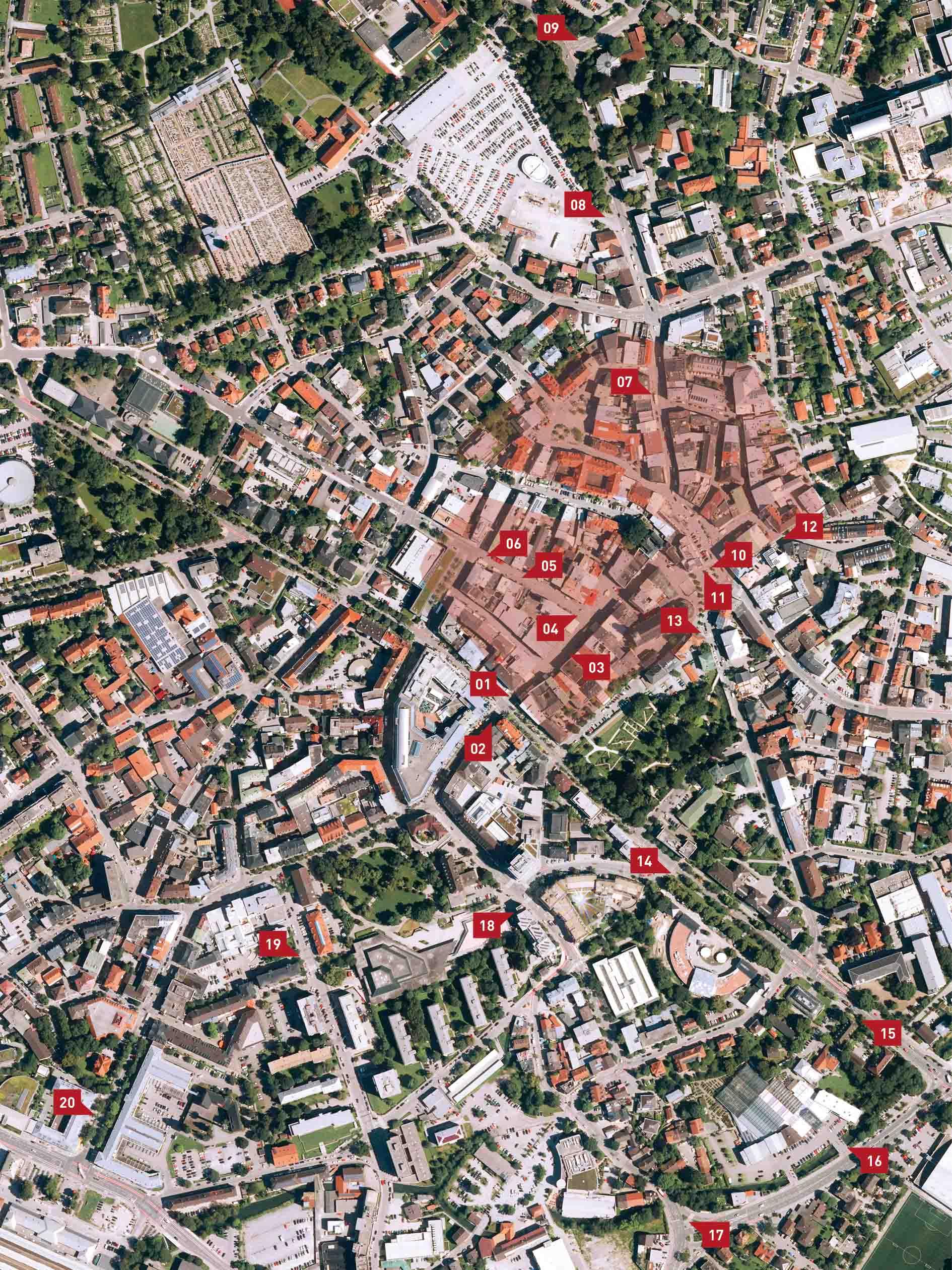
Twenty info steles illustrate the individual changes and invite you to take off on a journey of discovery. The images from the past contrast directly with the city as it looks today. This immersion into history provides the key to understanding the city as we now know it, and can also predefine the direction for future developments.
Texts, image selection, technical implementation: Landschaftsarchitektur Stiegler
Graphic design: Stephan Guggenbichler
Consultancy: Karl Mair, local history curator
Translation: Fachübersetzungen Hunger/Altmann GbR
RosenheimKreis e.V. initiated the info steles in 2014 as a temporary exhibition in public spaces. The Rosenheim Historical Society published the historical sites as a book in 2016. The city of Rosenheim took on the idea and will situate them permanently in 2020.
“Schlössl” manor house on Münchener Straße
01 Location, Max-Josefs-Platz 1
Level crossing on Max-Josefs-Platz
02 Location, Münchener Straße 1
Münchener Tor
03 Location, Max-Josefs-Platz 14
Old town hall
04 Location, Max-Josefs-Platz 13
Heilig-Geist-Straße 7
05 Location, Heilig-Geist-Straße 8
First hospital
06 Location, Heilig-Geist-Straße 14
The Wiesentor gate
07 Location, Kaiserstraße 15
Loreto-Allee
08 Location, Kaiserstraße 23
Kaiserbad
09 Location, Kaiserstraße 44 (junction with Rechenauerstraße)
Inntor gate on Ludwigsplatz
10 Location, Ludwigsplatz 31
Nikolauskirche
11 Location, Ludwigsplatz 31
Gate to the dyers’ quarter
12 Location, Färberstraße 17
Königschule
13 Location, Ludwigsplatz 4
Rosenheim’s first train station
14 Location, Rathausstraße 22
The first railway line
15 Location, Rathausstraße 30
Huber ropemakers
16 Location, Briançonstraße 5
The “Messinghammer” site
17 Location, Kufsteiner Straße 42 (traffic island)
Bräu am Anger
18 Location, Kufsteiner Straße 12
Salt works
19 Location, Salinstraße 6
Rosenheim’s second train station
20 Location, Bahnhofstraße 12